Other Sites
Good Birding Sites are Closer Than You Think
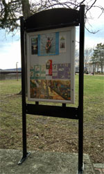
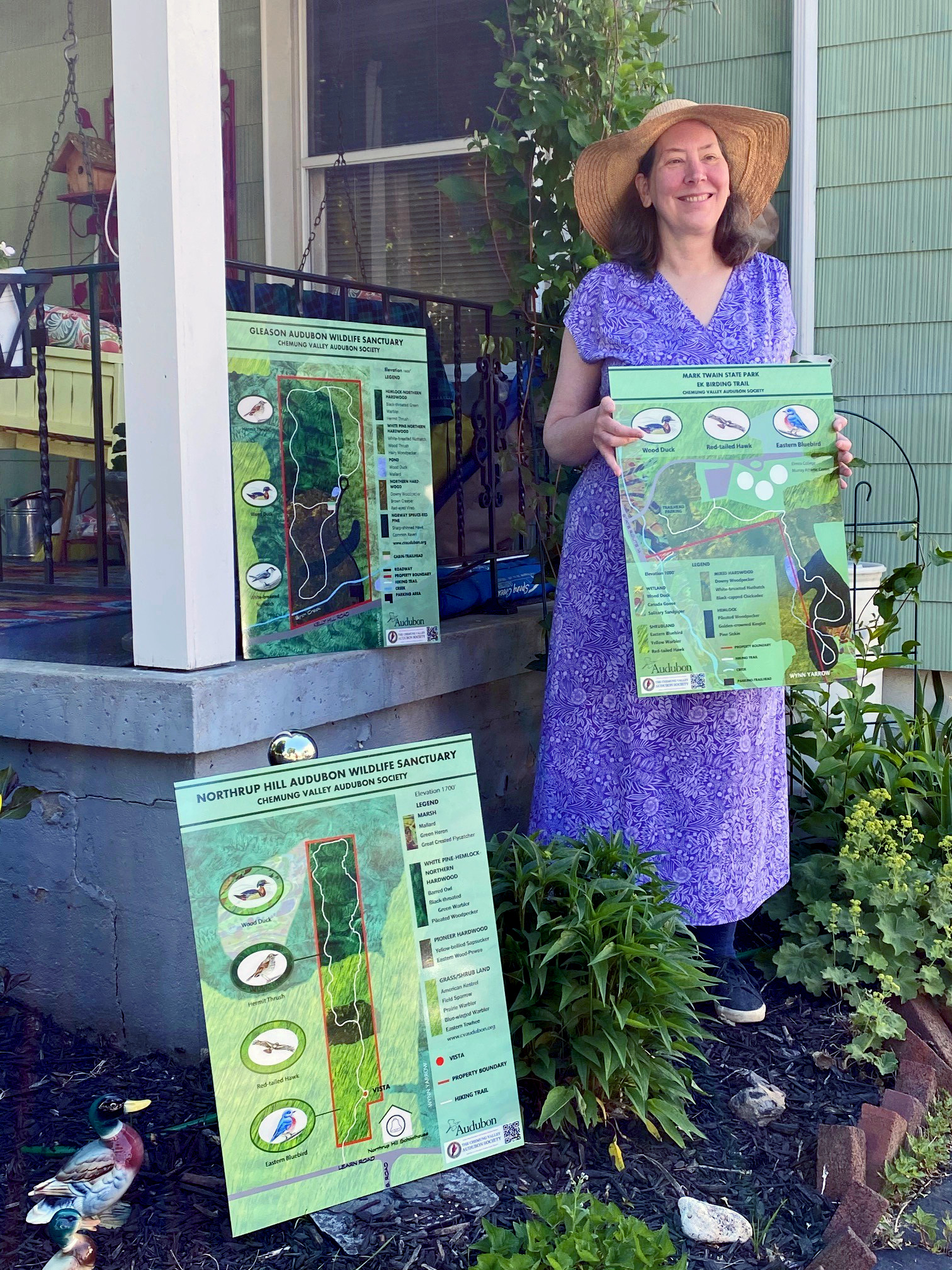 Our sanctuaries and local parks are wonderful places to explore and you'll often find some unique features to help you on your journey. For example, a grant from the National Audubon Society allowed CVAS to commission local landscape artist Wynn Yarrow to create colorful and informative trail signs at Northrup Hill, Gleason, and Mark Twain State Park.
These trails are maintained for easy access and are open to the public during daylight hours for hiking and birding. Hunting, trapping, and motorized vehicles are prohibited. Pets must be leashed so as not to disturb wildlife, with no exceptions.
We will continue to scout new birding locations in our area and add them to this page. For more pictures--and for bigger versions of these pictures--check out our interactive map. Our map also has many more sites for you to explore! GOFINGERLAKES is another great resource for birding sites and information. From their article, Best Birding Spots in the Finger Lakes:
Over 300 species of birds have been recorded in the Finger Lakes region. If you are a beginning birder, it’s a great place to get started. If you are already a die hard, you can devote hours and hours, week after week, to birding here and never run out of rewarding discoveries. And whether you live in our region or are here just for a short visit, you have endless options about where to find the birds, all year round.
Audubon protects valuable habitats and the birds that depend on them: Important Bird Areas (IBA). Find IBAs in our area at Audubon.org.
Plymouth Woods Nature Preserve
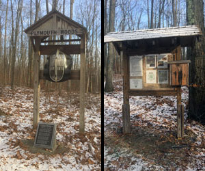
One of thirty-two nature preserves conserved by the Finger Lakes Land Trust, the 88-acre Plymouth Woods Preserve includes a mature oak-hickory forest, a ravine, and a small wetland. A wide variety of birds typical of hardwood forests can be found on the 1.6 miles of trail. For more information, click here.
Directions
From Route 17/I86 east of Elmira, take the Church Street, Route252 exit, Exit 56. Travel west through Elmira, and turn left on Route225 (Hendy Creek Road). Go about 3 miles and turn right onto Kneale Road. Go 0.4 miles to the preserve parking lot.
Steege Hill Nature Preserve
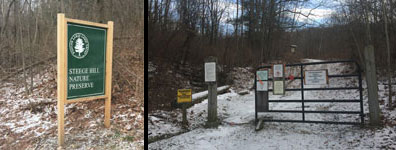
The Finger Lakes Land Trust's Steege Hill Nature Preserve offers numerous trails to walk and observe the abundant wildlife. While much of Steege's forest is dominated by southerly species such as oak and hickory, you'll find trees more typical of a northern forest–hemlock, maple, birch, and beech–in the glens. . Five ravines on the 793 acre preserve provide a cooler, moister habitat than is typical of the rest of the preserve. For more information, click here.
Directions
From Route 17/I86 in Big Flats, take exit 49. Turn south from the exit ramp and go to Olcott Rd. At the "T" intersection turn right onto Route 64 (unmarked), and right again onto Route 352. Turn left on South Corning Road. Cross the river, then turn left onto Steege Hill Road. Go about 1 mile. The preserve parking lot is on the left.
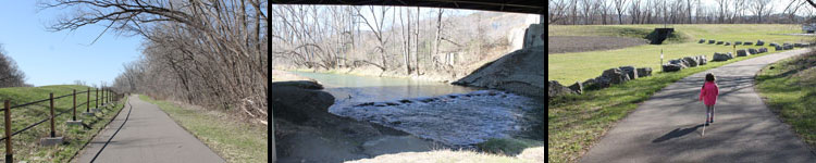
Catharine Valley Trail
Following abandoned railroad and canal towpath corridors paralleling Catharine Creek, the trail passes through a variety of forest and wetland wildlife habitats. The compact stone-dust trail surface accommodates walking, bicycling, cross-country skiing and snowshoeing. The trail is twelve miles long and extends from the Watkins Glen State Park to Mark Twain State Park. Most of the trail is on portions of abandoned Northern Central Railroad and Chemung Canal towpath corridors in New York’s Finger Lakes Region. The trail passes through the communities of Watkins Glen, Montour Falls, Millport and Pine Valley to Horseheads. For more information, click here. To download the trail map, click here.
Catharine Valley Trail Canal Loop September Species: 52
Directions
Several trailheads provide convenient access to the trail. Popular birding portions of the trail can be accessed at numerous spots along Route 14 including: Mark Twain State Park in Pine Valley; at the north end of Maple Street in Millport; at the north end of South Genesee Street; at Cook Street in Montour Falls; and on Decatur Street in Watkins Glen.
Queen Catharine Marsh
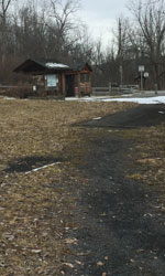
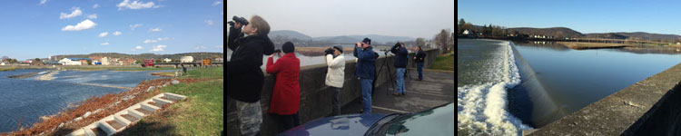
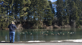
Queen Catharine Marsh is a 1000-acre protected wetland that extends northward from Montour Falls to the south shore of Seneca Lake. Its man-made ditches and potholes attract shorebirds, waterfowl, muskrats, and turtles, among other wildlife. An observation platform overlooking a large pool in the marsh is accessible from Rock Cabin Road. For more information, click here. During a CVAS field trip to Catharine Marsh on 4-13, 2019, 17 birders found 52 bird species, including waterfowl, eagles, herons, and a Yellow-rumped Warbler.
Queen Catharine Marsh September Species: 117
Directions
Excellent wildlife viewing spots, including the lookout platform, are accessible from Rock Cabin Road that travels north/south along the east border of the management area.
Brand Park
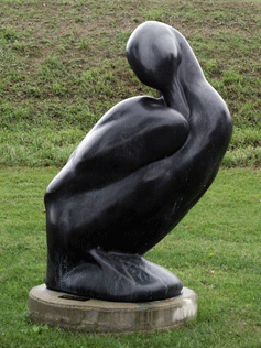
Brand Park features an oversized bronze rendering of the extinct Labrador Duck (photo at right), one of the Lost Bird Project series by sculptor Todd McGrain. The bird is memorialized at Brand Park in Elmira, where the last known individual was shot on December 12, 1878, by a boy in search of wild game for the family table.
The flood control levee along the north side of the park offers convenient viewing of a wide variety of waterfowl, shorebirds and raptors.
For more information, click here.
Directions
Brand Park is located at the south end of Madison Avenue bridge on Elmira's south side.
Riverfront Park
A meandering trail, extending between Elmira's Main Street Bridge and Lake Street Bridge, provides a variety of views of the Chemung River and access to fountains and public spaces. For more information, click here.
Directions
The park runs the length of W. Water Street, between N. Main Street and Lake Street, in Elmira, and a metered parking space is generally easy to find.
Chemung River and Elmira Dam
The Chemung River is one of the shortest rivers in the United States. It begins near the Village of Painted Post at the confluence of two other rivers -- the Tioga, which comes out of Pennsylvania, and the Cohocton, which flows from the northwest through the Village of Bath. In the short distance between the Pennsylvania border and the beginning of the Chemung, two other rivers, the Cowanesque and Canisteo Rivers flow into the Tioga.
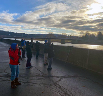
Some of the finest birding along the river occurs within the Elmira city limits. A low dam in the river in the downtown area interrupts the flow of the river and creates a shallow lake-like channel to the west from which the city draws about half its water supply. To the east of the dam, the river is wide and usually shallow.
Chemung River and Elmira Dam September Species: 69
Lackawanna Trail
The Lackawanna Rail Trail spans Elmira, New York, linking famous Eldridge Park with the city’s waterfront, then extending east for five miles linking Elmira with Lowman along Route 17/I86 and the Chemung River. The paved trail uses a former Delaware, Lackawanna and Western Railroad corridor for most of its route.
In the north, Eldridge Park offers a lake with an encircling walking trail, along with typical park fare such as a playground, baseball diamonds, soccer fields and picnic pavilions. Because the area was once home to an amusement park of the same name, a restored carousel, dance hall pavilion, game arcade and ice cream shop are also featured.
A spur takes trail users east from Eldridge Park along Diven Creek to Lake Street. The main route extends south from the park, paralleling Clemens Center Parkway before turning to the east at E. Washington Street. Refurbished railroad bridges take trail users over cross streets. At the southern end of the Elmira section, the trail follows Newtown Creek, offering a peaceful setting.
For more information, click here.
Mill Street Park
Located on East Mill Street in Horseheads, this spring-fed small pond’s open water provides year-round viewing of waterfowl. There is a picnic area with a pavilion and charcoal grill.
Mill Street Pond is stocked with trout by the Chemung County Sportsmen’s Federation, Horseheads American Legion, Horseheads Police Benevolent Association, private individuals and the Horseheads Youth Bureau. Fishing is restricted to youth ages 15 and under, and agencies or organizations representing disabled or handicapped persons.
Directions
From Route 17/I86, take exit 54 for NY-13 North. Continue on Route 13 for approximately 1.1 miles. At the traffic circle, take the 3rd exit onto E Franklin Street. In approximately 0.2 miles turn left onto East Mill Street. Parking is available at the picnic pavilion in the park.
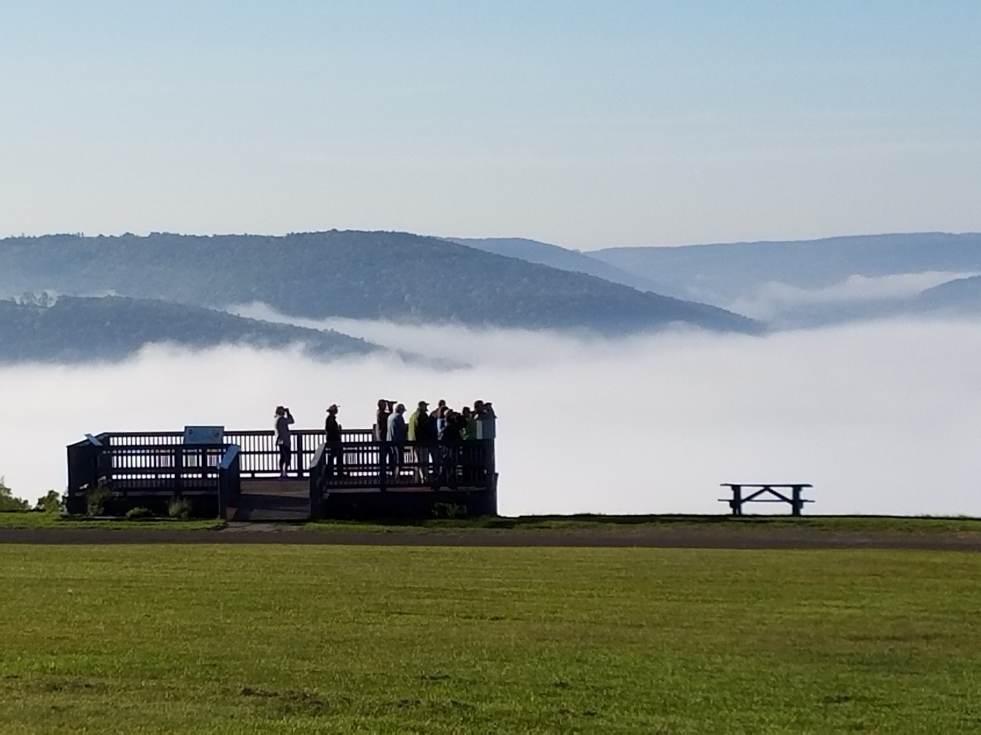
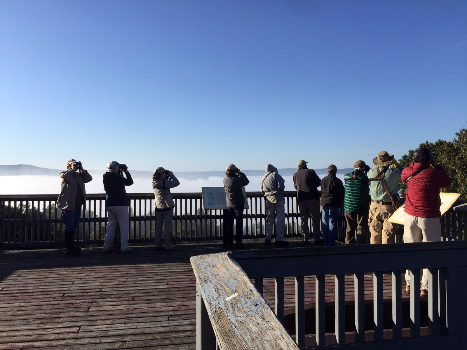
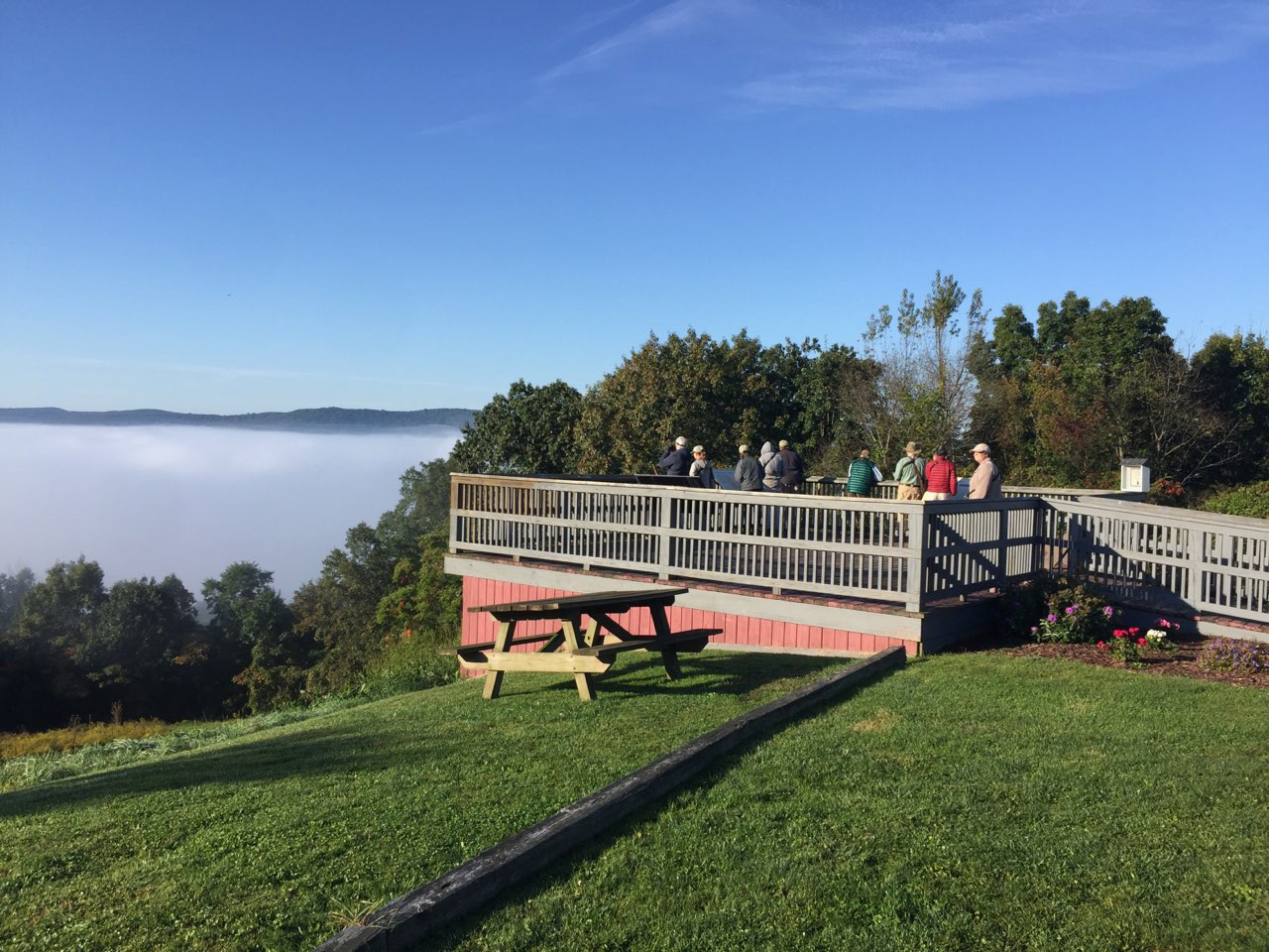
Newtown Battlefield State Park
 Sullivan's Monument |
 Sullivan's Monument |
 Sullivan's Monument |
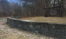 |
This small state park is a memorial to a Revolutionary War battle between the American army and a combined force of British, Tory, and Iroquois. The park is primarily a hilltop forested site with shrubby edges. The forest includes deciduous, a Pitch and White Pine stand, and Red Pine stands. For the trail map, click here.
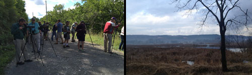
In the right picture, CVAS members take a soothing September stroll through the park, as the autumn morning mist rolls up the mountainside.
Directions
From Route 17/I86, take exit 56 for NY-353 toward Elmira, Jerusalem Hill. Turn on NY-352 East onto Jerusalem Hill Road. In approximately 0.3 miles, turn right onto Brant Road, County Road 60. Continue 3.2 miles. The entrance to the state park is on the left.
Sullivanville Dam
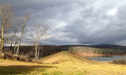
After a major flooding of the Chemung River in 1972, the Army Corps of Engineers constructed several flood control dams on tributaries of the Chemung. One was built on the north branch of Newtown Creek near the hamlet of Sullivanville. A parking area at the top of the dam provides public access. From the top of the dam, the entire water impoundment and surrounding hilltops can be viewed. Where the creek flows into impoundment, mudflats have formed. A short trail leads north through the woods.
The hiking trails provide access to a 20-acre lake, three successions of forest, and a visible glacial plate.
Sullivanville Dam September Species: 90
Directions
From Route 17/I86, take exit 54 for NY-13 N toward Ithaca. Continue on Route 13 for approximately 1.1 miles. At the traffic circle, continue straight on Route 13 North (2nd exit) for approximately 1.8 miles. At the 2nd traffic circle, continue straight on Route 13 North (2nd exit) for approximately 0.2 miles. The entrance to the parking lot is on the right side. For more information, click here.
Kehoe Nature Preserve
This location, located in Golden Glow Heights, Town of Elmira, has an abundance of trees and wildlife. It was previously called Stanley Woods, but is now known as Kehoe Nature Preserve.
Harris Hill Park
This county park is the location of the National Soaring Museum and figures prominently in the nation’s history of sailplanes. Picnic areas are in a stand of Pitch and Eastern White Pine. Around this are deciduous woods and grassy fields.
Harris Hill Park September Species: 68
Park Station Park
This site is a county park at the site of another post-1972 flood control dam. The impoundment here is a small lake surrounded by deciduous forest, a Red Pine stand, a White Pine stand, shrub land, grassland, streams, and cattail marsh. Find more information here.
Park Station September Species: 71
White Wagon Boat Launch - Junction Canal Towpath Trail
Starting at the White Wagon Boat Launch ramp, the Junction Canal Towpath Trail extends eastward for 1.2 miles along the south bank of the Chemung River following the towpath of the former Junction Canal. The well-maintained trail travels through an old-growth riparian buffer habitat and offers close views of the river.
Completed in 1858, the canal connected between Tioga Point, Athens, Pennsylvania, and the Chemung Canal in Elmira. The 18-mile long canal, featuring 11 locks, was last used in 1871, then abandoned. The boat launch site features a pavilion with electricity, benches, and rest rooms with running water.
Directions
From Route 17/I86 heading east from Elmira take exit 59A, Wilawana, near the eastern boundary of Chemung County. Turn north onto White Wagon Road. Go about 0.6 miles, behind the CVS distribution center. The boat launch parking lot is on the left.
Map Coordinates: 42.007126, -76.577134
Widger Hill Area - Audubon NY IBA
One of 132 Important Bird Areas (IBA) identified by Audubon New York, the Widger Hill Area offers a variety of habitats including woodland, freshwater wetland, shrub/scrub and grasslands.
Located at the intersection of Widger Hill Road and Kinner Hill Road, along the Chemung County and Steuben County line, the 415 acre area is privately owned but can be viewed from a vehicle or by walking the roads.
A variety of species have been identified in the grassland areas to the west of Kinner Hill Road including Henslow's, grasshopper and savannah sparrows, eastern meadowlarks, bobolinks, bluebirds, killdeer and woodcocks. A variety of waterfowl visit the site in spring, early summer and during fall migration.
Directions:
From Corning, take Route 225 to Caton. At the main intersection in Caton, go straight onto Marsh Road (Route 32) and stay on Marsh Road to the end. Turn left following Route 32. In 3.5 miles turn right on to Birch Creek Road. Follow Birch Creek Road for one mile and bear left onto Hamilton Road. Stay on Hamilton Road to the end (0.8 mile). Turn left on to Kelly Hill Road. Proceed approximately one mile passing houses to the intersection with Widger Hill Road. Turn left. The grasslands are located to the left; the wetland is located approximately 0.1 mile to the north at the intersection with Kinner Hill Road.
From Elmira, follow Route 328 South to Sagetown Road. Turn right onto Sagetown Road. In approximately 0.4 miles, turn left onto Kinner Hill Road. Remain on Kinner Hill Road for 3.6 miles and the intersection with Widger Hill Road. The wetlands are located on the right side of the road. The Widger Hill grasslands habitat is located in the fields across Widger Hill Road.
Coordinates: 42°00'41.0"N 76°57'56.7"W
Note: the CVAS Gleason Audubon Sanctuary property is located approximately 4.1 miles west on Kelly Hill Road.